We left busy Brizzy behind us and started our crossing through the heart of Australia, from East to West.
Now, one might think this is the most boring route one could ever take … Fact check: nope, there are more boring roads! And yes, we actually discovered some interesting places! Although it is a long way to Birdsville, and then up to Mount Isa from where the crossing is about midway. Let’s say some 2400 km’s!
In Dalby we met an interesting guy working in the local handy-man store. He repaired our leaking gas lead (yeps, that is dangerous when you’ re camping and using a stove!) but appeared to be 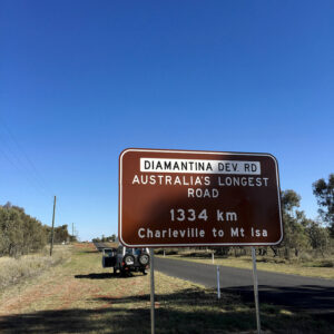 not just another farmer in this massive country who hadn’t heard of any place outside Australia. This man was completely into India, we guess he wouldn’t mind spending his pension overthere 🙂 His daughters lived in Brisbane, which seamed a logical choice to us: warm, beach, city … Dalby is a small farmer community. That’s it. In a valley, and although only some hours from Brisbane, experiencing a completely different climate (read: cold!). Just passed Dalby, we found an interesting reminder of the early pioneers: the Cactoblastis Memorial. Apparently, a plant (the prickly pear) was introduced in Australia and found the fertile land a heaven for its own reproduction. This resulted in a massive plague, with no fertile land left for the farmers. Again an example on why it’s never a good idea to release animals or plants into a completely different environment. At a certain point in time they even considered to enroll tanks and flame throwers to extinct the plant. The solution came from a small but hungry animal: the cactoblastis moth eat all the prickly pears and that was that!
We stopped at Roma to get some information on our route ahead, but didn’t stay long enough to find out more about the more history of this town. The Visitor Centre does give an impression about that history: with a big oil drill installation on the roof one cannot deny the importance of oil drilling around here … And Roma happens to have the biggest sale yard of the southern hemisphere (yes, here we are again, the biggest!. However, we did spot our first bottle trees! More on bigger trees in a later post! Now the Diamantina Road lies before us!
In Morven we found a special but ‘no-we-wouldn’t-stay-there’ house: the Kerosene Hut. Not sure how it smells inside, but the place is build on empty kerosene barrels … Guess you have to tempt people to visit your small outback town 🙂 We stayed at the free camp place in town, witch even had showers and toilets (as we will learn later, that is just luxury!). Try your luck at Wikicamps to find good camp spots! A bit bigger town eastwards is Charleville. It is a great stargazing place and the Cosmos Centre is definitely one of the more interesting places, unfortunately closed when we were there … At the Cosmos Centre you can view the spectacle high above at night, or go on a tour during the day. Charleville is also ideal to find a Bilby, a small and endangered animal. And of  course, the first passenger flight of Qantas, in 1922, was between Charleville and Cloncurry (where we’ve been in 2013).
Another interesting place here is the Royal Flying Doctor Service Hangar. It is still in use and was first build by the Americans during World War II (for war purposes of course). The RFDS started using this base in 1943, and ever since they assist people in (medical) need in remote areas (the work base of the Charleville Doctors covers about 622.000 square kilometres!). The museum gives an idea about the exceptional work they’ve done ever since. But this base was also the place from where all (yes, all) inhabitants from Charleville were evacuated in 1990 when the town flooded and was nearly destroyed (the water rose to 8,5 meters above the normal level!).
The next stop we would like to tell you something about is a small place called Quilpie. Deserted and small, so you might wonder what’s special about it. Well, the water is kind of special … We found a nice camp spot, with a clear warning sign to take of all silver jewels before using the – bore – water. Of course, I forgot to take of my wedding and engagement rings! While doing the dishes, they turned copper colored. Panic around our small camping spot … But after some hours, they returned to their beautiful silver color again. Lucky me 🙂 (and since we’re home, they shine like brand new again) So what’s with the water?
This region is situated on the Great Artesian Basin, a giant groundwater basin. Communities have to bore their water before it can be used as drinking water, because of the high pH and sodium levels (the water has to be cooled). In addition, the water smells because of the sulphur gas. And that’s what causes the tarnish of silver … It is a bit sticky too, and it tastes strange, but at least the people who live in these harsh conditions found a way to build a future around here. If there is one lesson you learn while traveling through Australia, it is how precious water is, and what the consequences of climate change really are!
 From Quilpie on you feel like you’re really entering a country where no one else before you has been … Of course that’s not the case 🙂 From the mid-19th Century, pioneers tried to cross and develop the outback, driving their horses and camels. Lot’s of roads and places are named after these men: Stuart, Burke, Wills. The Simpson Desert was first crossed (with camels!) in 1939, with the help of aboriginal people (let’s not forget, the Aborigines have lived in Australia for millions of years; referring to ‘development’ must be read in the sense of ‘Western development’ which wasn’t always – light expressed – for the better of the native people).
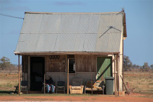
Along the road, we regularly stopped at homesteads and sheds. These limestone houses are quiet reminders of the early exploration times. It is just unimaginable! There is, literally, nothing around. No water, no trees, no roads (at that time), no possibility to grow anything, no communication (it is late 19th Century). And still, people lived here. Afghan people (as handlers for the camels, so actually helping to ‘develop’ Australia with building roads, train ways and transporting goods and water), early settlers, pioneers. That’s how towns such as Birdsville, Bedoorie, Marree, … came into existence. To get to these places, you have to take the turn-off at Windorah. The last place to collect some tourist brochures or get an update of the road conditions. Crazy to see giant solar panels too …
And although one can feel as the last man on Earth, a lot of life is actually around you! Kangaroos, camels (yeps, they survived!), snakes, even fish! That’s what we saw at the Cooper Creek near Cluny Station. Abundant with wildlife and flush green! Crossing this continent truly is a unique experience! One of those magic Outback places is definitely Deon’s Lookout! We’ve heard from friends it is kind of creepy during the night, which it was indeed. We had the place all to ourselves: the sunset, the stars and milkyway, the sunrise, the silence. Absolutely wonderful! (although it is named after a young man who crashed with his helicopter nearby)
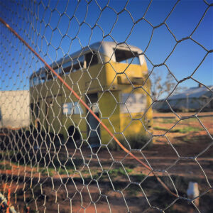 On our way to Birdsville we passed the ghost town of Betoota. Once it had a post office, a police station and three hotels. Since about 2002 it is deserted, when the last hotel owner moved (the man is buried at the back of the hotel). And despite of the Betoota Gymkhana in April and the Simpson Desert Racing Carnival each last weekend of August. So if you want to experience this place like we did, don’t go in April or August 🙂 A lovely break in the view other than rocks, sand and dust is the giant Dreamtime Serpent. It is made out of gibbers and stones found throughout the Diamantina Shire and represents “a series of pathways travelled through Country to connect the river systems in the Channel Country of the Diamantina Shire”.
From Betoota it’s only a few kilometers to an actual town. And the biggest around here! Birdsville shows up at the horizon after hundreds of dusty kilometers. People are always excited to get here. Literally in the middle of nothing, from either side you’re coming … Most people will arrive from the Birdsville Track. One of those have-to-do outback tracks which every Australian once do. Others arrive after crossing the Simpson Desert at the western edge of town. Food, fuel, a shower …Heaven in the desert 😉 We arrived along the Racetrack side of town. Birdsville is famous (at least in Australia) for its Birdsville Races, every first Saturday of September. They are also known as the Melbourne Cup of the Outback. First we figured out where to sleep.
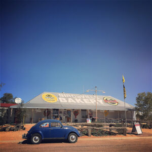
You cannot free camp in the town, but from one meter outside the town it is just fine. We stayed between the dry river bed – high and far enough just in case – and the Diamantina River (yes, there is water in the desert!). Than we visited the, yes, also, famous Birdsville Bakery. Oooh, we were looking forward to this! We came in the right time, since the bakery is only open from Easter till October. Big disappointment to find out there was no such thing as fresh bread (damn travel guide!). So we paid for the most expensive and not-at-this-place-baked bread ever: $ 7 for a healthy wholemeal bread. If you’re not into healthy food: the white bread was a lot cheaper! At least we got something that gave us the necessary energy to explore the town. About 35 km out of town, we went to the Simpson Desert boarder.
No intention to go into this National Park, but we did wanted to see the Big Red sand dune. It is the highest dune (40 meters) of the Simpson Desert, and the last obstacle (or the first) when crossing the Desert. What’s one dune after 1140 behind you?! The view from the top was absolutely marvelous, and climbing it was fun 🙂
 In town there are two hotels: the ‘new’ one (aka Birdsville Pub), and the ruin across the street. This ruin was the Royal Hotel (1883), but after a few decades it became the Australian Inland Mission Hospital. After some other destinations the building unfortunately needs a proper restoration. We didn’t get to the Birdsville Billabong. Guess we’ll have to come back one day 🙂 Isn’t it amazing to have so much life in the middle of nowhere? We actually crossed another river where we were just stunned to see pelicans and other beautiful birds, also in the middle of dusty nowhere.
But we did see the Burke and Wills Dig Tree! This is an Australian icon. Burke and Wills were two pioneers/explorers, and where so kind to engrave their initials in this particular tree. Although not the first to come this way: Sturt was here 15 years earlier, in 1845. In the late 19th Century, Birdsville became an important stop for cattle drovers, en route to the south.
 And we met Onslo: the blue Volkswagen Beetle which made it trough the desert and sand. It belonged to the late Kelly Theobald. A young woman who moved from Adelaide to Birdsville, stayed here and made this little outback town famous to the world with her stories and pictures of the adventures of Onslo. She died in a car accident in October 2015. When leaving to go further up north, we passed the Power Station. Special because it is a low-temperature geothermal power station, drawing water from the Artesian Bore (remember Quilpie) and providing electricity from the steam. And you can wash your car for free!
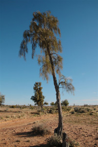
About 12 kms out of town, you’ll have to make another quick stop to take a good look at the Waddi Trees. They can only be found in three places in the world, with some of them being more than a 1000 years old! Fun fact: the wood is so hard it can barely be damaged (not even by fire!). Before driving another few hundreds kilometers to Mount Isa, there is one more stop you should make (about 200 kms north of Birdsville): Bedourie. Some interesting facts: the Bedourie Camp Oven – essential for the survival of the drovers, the Mud Hut and the Bedourie Races (second Saturday of September, after the race in Birdsville), and an art work representing a sand storm – or for the indigenous people: the spirits that are traveling.
the way to birdsville from Travel for Motion on Vimeo.
